The Impact of Waldo Dam
on The Spenceville Wildlife and Recreation Area
if it ever were to be built.
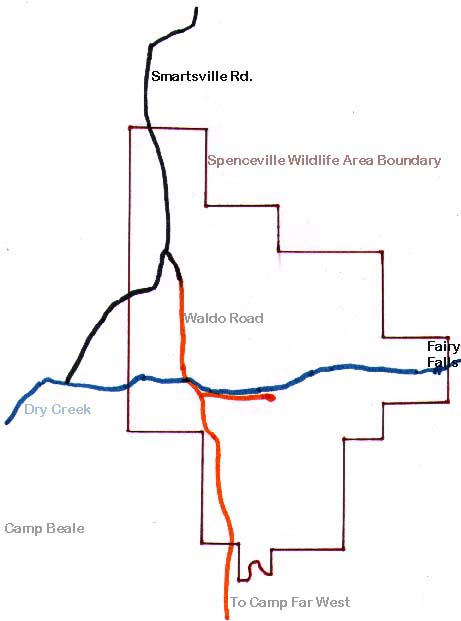
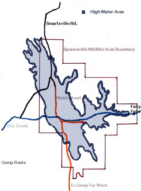
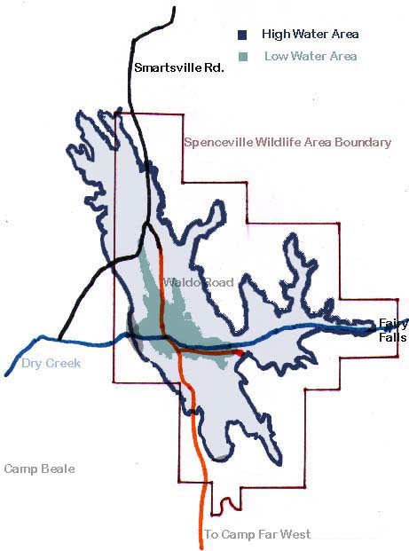
We have prepared three thematic maps to represent the spatial extent of this impact.
| Map of SWRA at Present | Map of SWRA Showing the high water impact | Map of SWRA Showing the high water pool, the low water pool and the dams |
The impact of the proposed Waldo Dam on the Spenceville Wildlife and Recreation Area (SWRA) is summarized in the following data.